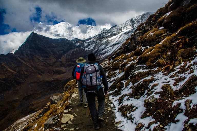
The Goechala trek is conducted in Kanchenjunga National Park and takes about 9 days to complete; that is the duration at a leisurely pace. The distance covered is roughly 90 km, 45 km out and back, and goes to a height of about 16,000 ft (4,800 m). The main attraction is a grand view of Mt Kanchenjunga as the sun rises but that’s not all that this trek offers. It has some truly spectacular scenery to offer up too.
The best time to go for this trek is from March to May because that is the time that the hills are covered in rhododendrons in bloom and are said to be a sight to behold.
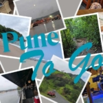
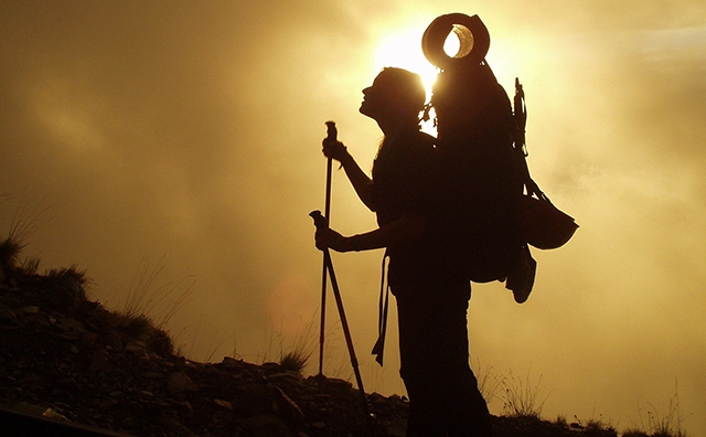
Shortly after I got back from my first trek, to Roopkund, I was already planning my second trek. After giving it some thought, I decided that the next destination for me should be Sikkim. I had been there once as a kid but didn’t remember much of it. Plus, I remembered that the trek leader for the previous trek did mention that they will start treks in Sikkim soon. After taking a quick look through the treks available, I found what I was looking for. I was going to go for the Goechala Trek in Sikkim.
So, without further ado, let us skip to November of 2014 when I went on the best trek I’ve been on yet.
The itinerary
It was a simple, 11-day itinerary and read like this:
- Day 1: New Jalpaiguri (NJP) to Yuksom
- Day 2: Yuksom to Sachen
- Day 3: Sachen to Tshokha
- Day 4: Tshokha to Dzongari via Phedang
- Day 5: Rest day in Dzongari
- Day 6: Dzongari to Thansing via Kokcharang
- Day 7: Thansing to Lamuney
- Day 8: Lamuney to Goechala via Samiti Lake back to Kokcharang
- Day 9: Kokcharang to Tshokha via Phedang
- Day 10: Tshokha to Yuksom
- Day 11: Yuksom to NJP
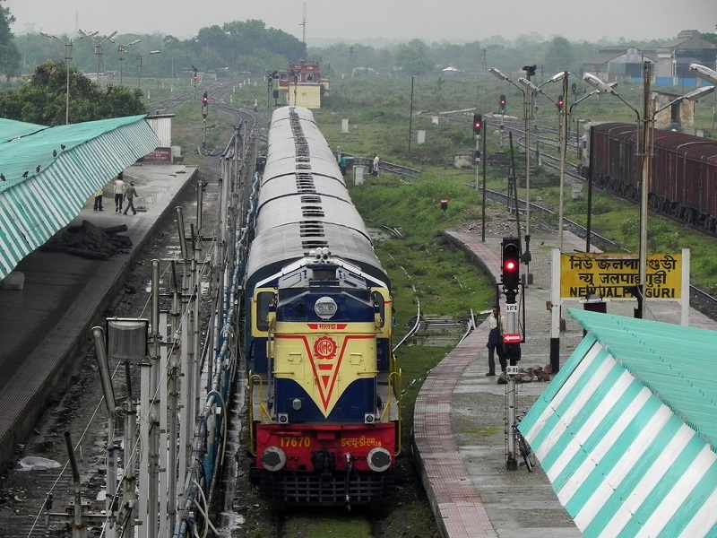
Day 1 of the Goechala Trek: New Jalpaiguri (NJP) to Yuksom
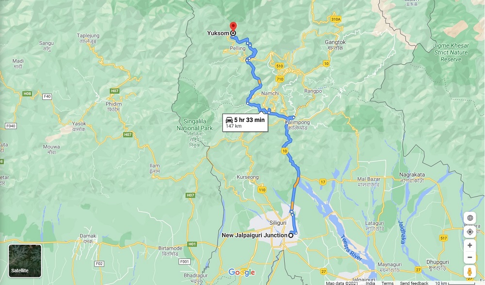
Getting to the start point was simple enough. All the trekkers were supposed to meet up at the New Jalpaiguri Railway Station. From there we would be driven about 150 km north to the city of Yuksom in Sikkim. We did as request, with minor alterations to pick up points but when we were all together, we were able to complete the meet and greet and introduce ourselves to one another.
The group had a group of 5 friends from Mumbai and 3 individuals, including me; all in all, it was just 8 trekkers. This was shaping up to be good already (I like trekking in small groups as opposed to some trekking companies that take upwards of 20 people at a time).
We all piled into our transport, which was a Mahindra Bolero (I think) and started. The first bits of the drive, heading out of the city, are typical of the plains. Long straight roads with vegetation on either side but the closer we got to the border between Sikkim and West Bengal, the more winding the road got. Once we were through the border, it just turned into a usual drive in the mountains.
There were twisty roads which were undergoing repairs in some places and was being widened in some others. We even had long segments where we would have the river Rangeet either to our left or to our right.
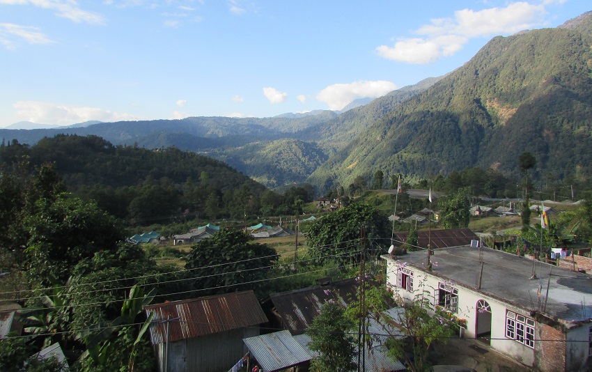
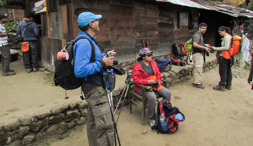
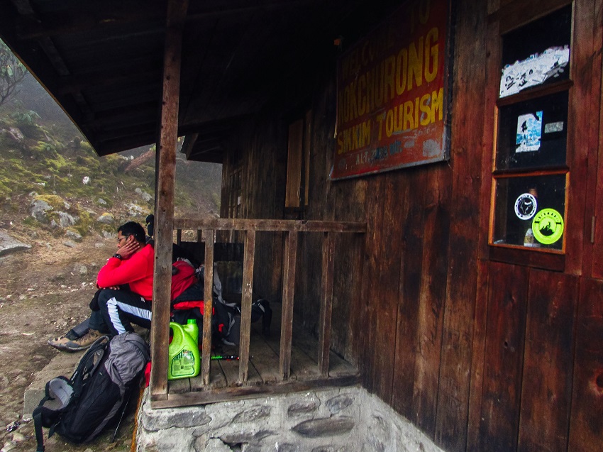
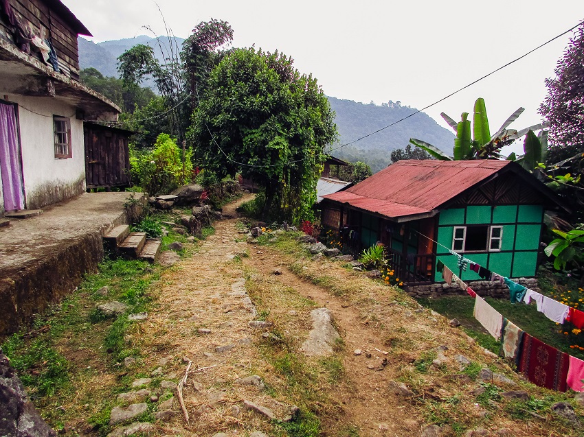
It was just a drive of 150 km, but it took us quite some time to cover it and it was just after dark that we reached Yuksom and our hotel. It had been booked by the organisers of the trek and it was a nice little place with about 7 or 8 rooms. We quickly split up into groups of 3 and settled into our rooms. Later that evening we were briefed about the trek and formally introduced each other. After dinner we repacked for the trek, decided what we won’t be needing and left it behind in a bag, to be collected at the end of the trek.
Day 2: Yuksom to Sachen
This was the day we started walking but we didn’t start too early because the destination, Sachen, was not too far away.
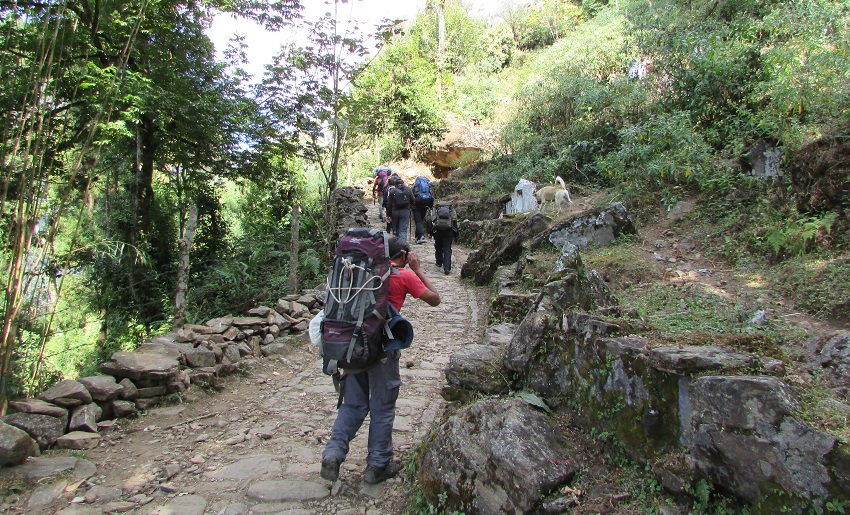
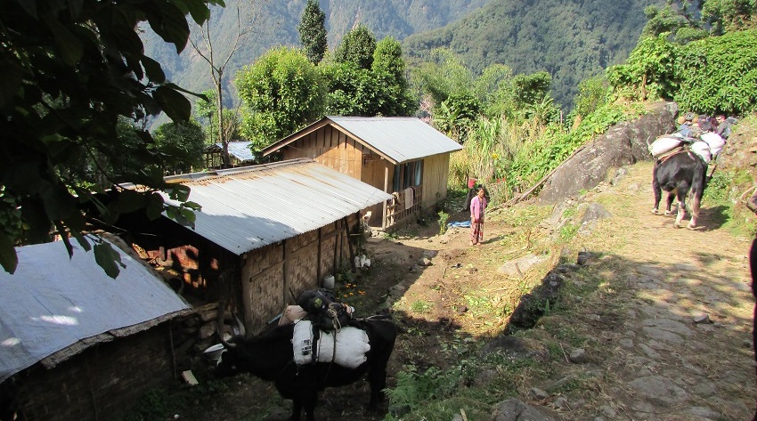
After a quick warm-up we headed out of the village and into Kanchenjunga National Park where we were told that if we wanted, we could use any of the streams to fill our bottles since everything was clean and fresh.
After a quick break to eat our packed lunch, we reached the campsite of Sachen (7,200 ft or 2195 m) where we were given out tent assignment. Through some error in counting, and a lot of luck, I wound up with 1 tent all to myself. We were then called to the kitchen hut to have our lunch.
The rest of the day was spent just relaxing. It had been an easy day, but I still didn’t feel like we had arrived since the campsite was just by the side of the trail and not on an open plateau or anything like that.
That night we were told the plan for the next day, fed our soup and dinner and then told to get some sleep.
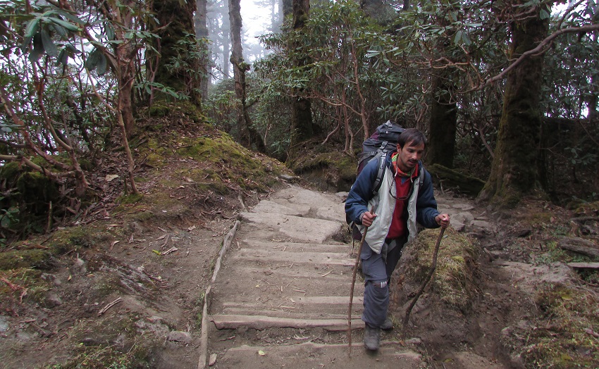
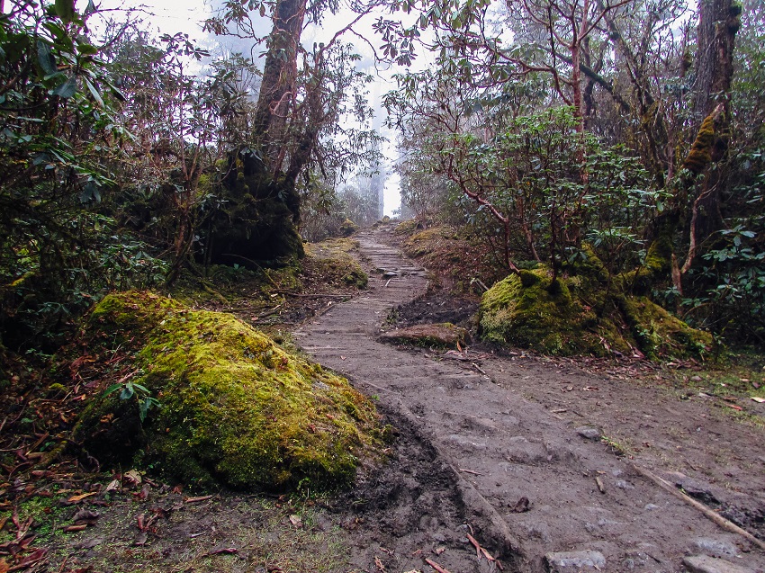
Day 3: Sachen to Tshokha
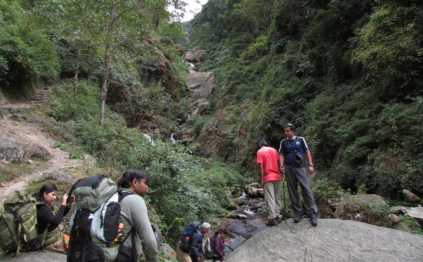
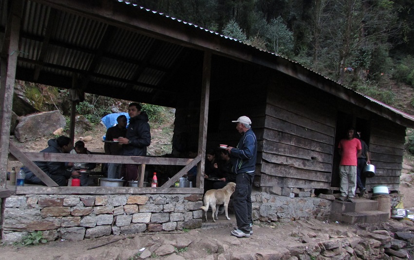
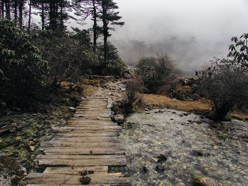
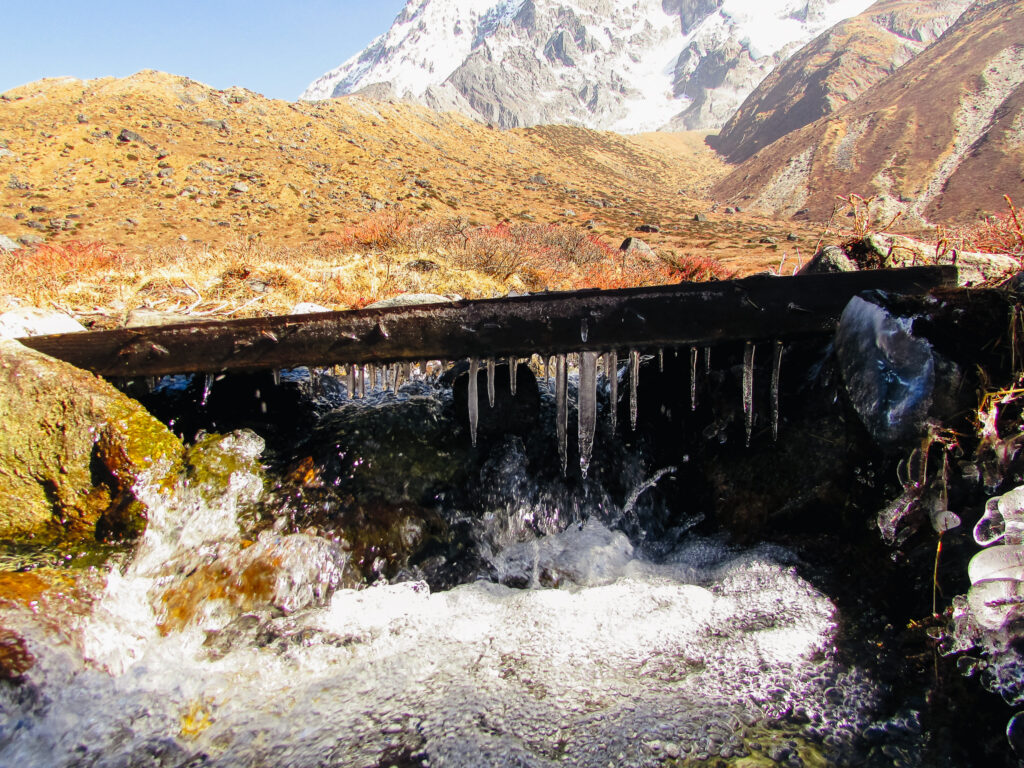
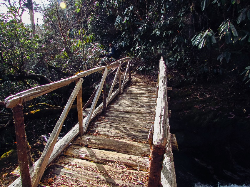
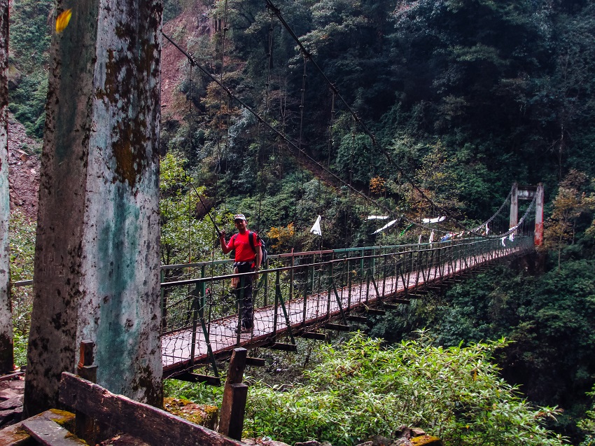
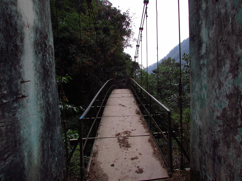
The next day’s climb was to the next campsite at Tshokha at an altitude of 9,700 ft (2956 m). The climb wasn’t a tough one and on the way we passed a fallen trees, a suspension bridge and a small canteen hut.
We stopped at the canteen for a short while and met an absolutely fascinating person. He was a retired gentleman, from Bengal ,trekking with his wife. He turned out to be an avid trekker and was soon telling us stories from the numerous treks he had gone on in the past. He seemed to have done almost every trek there was to do in India and Nepal.
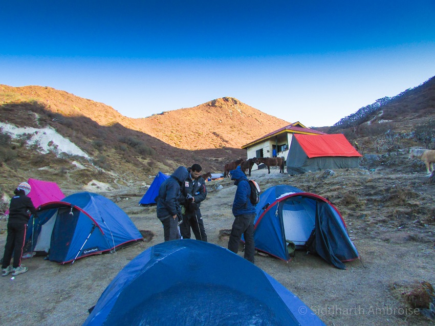
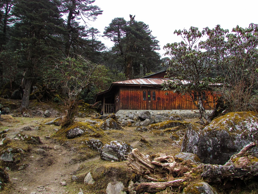
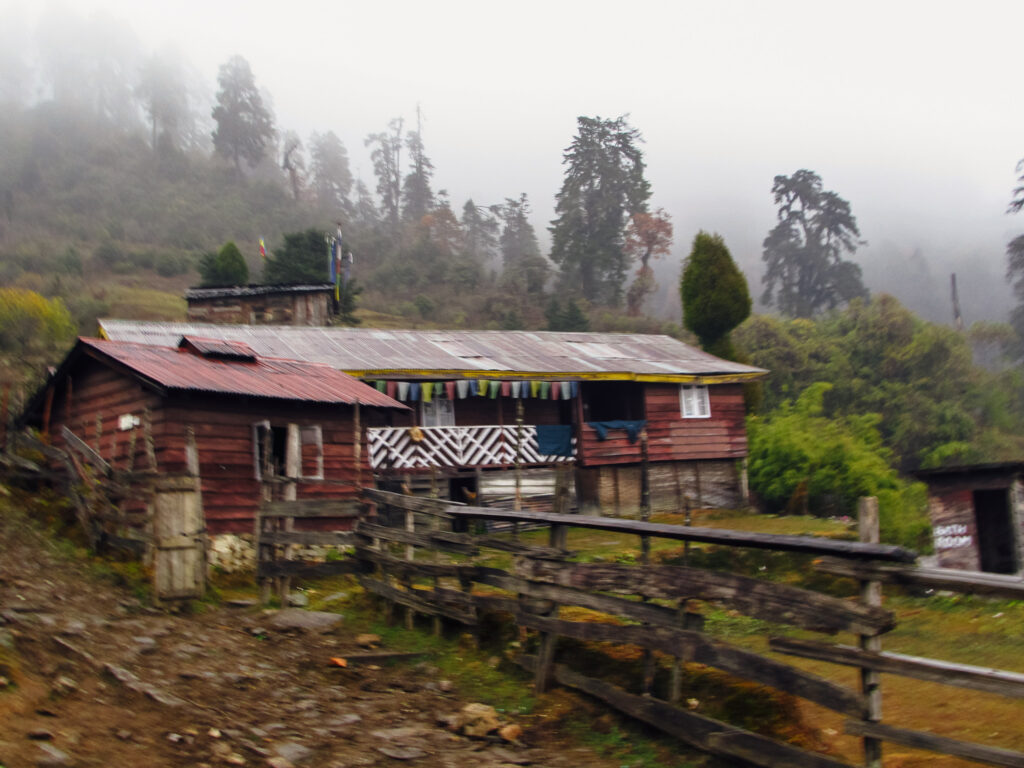
After the break at the canteen we continued the climb and reached the campsite in another hour. The fact that it was a bit crowded did not, in the least, detract from how perfect this campsite was. Even though the groups from other trekking companies got there first, we managed to find a nice little spot for ourselves. Just as we set up camp, we were treated to a nice lunch of macaroni.
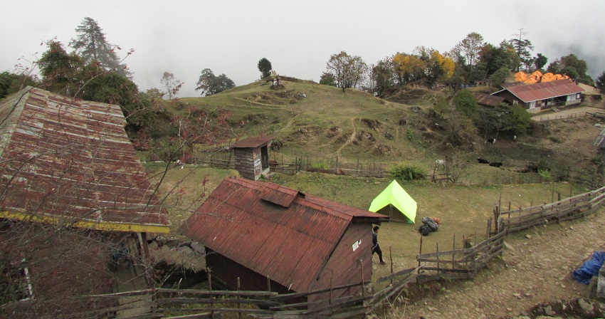
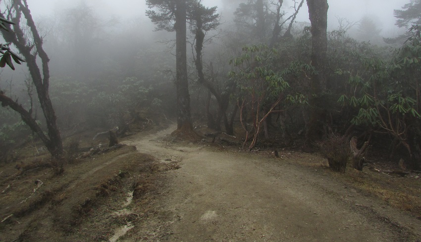
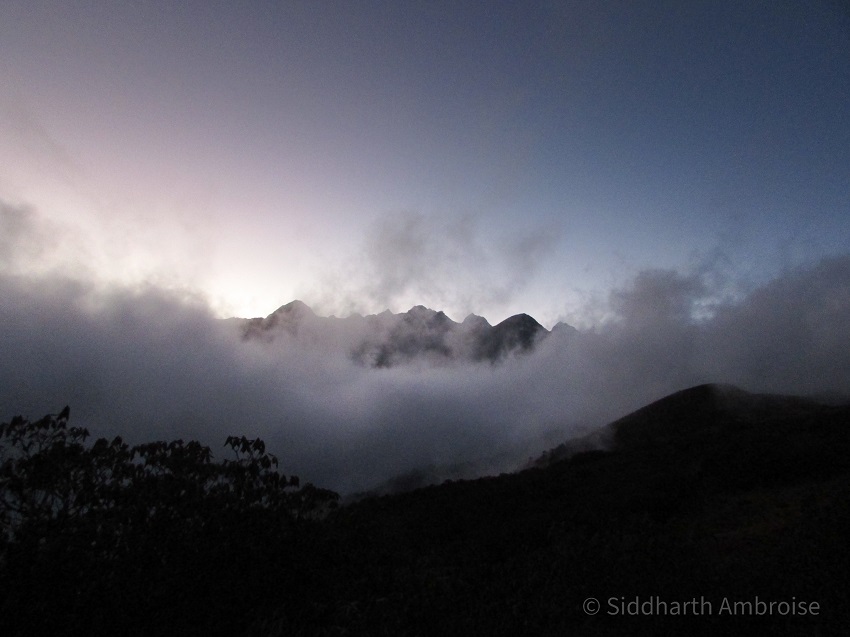
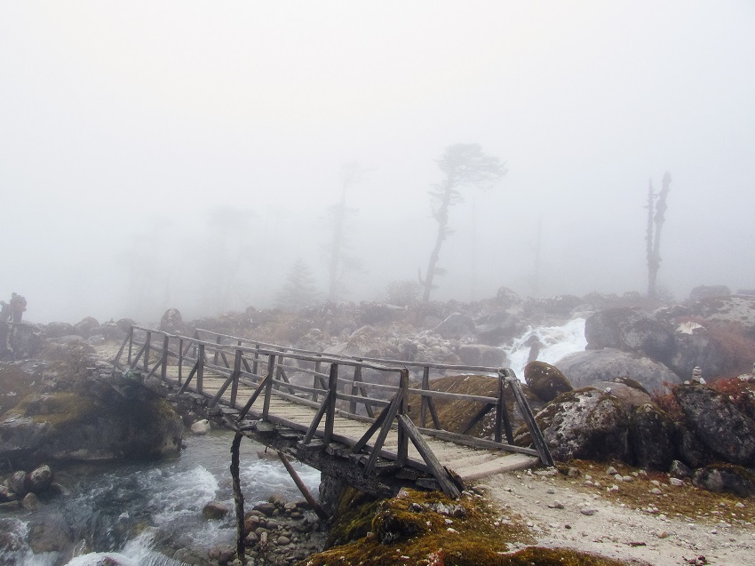
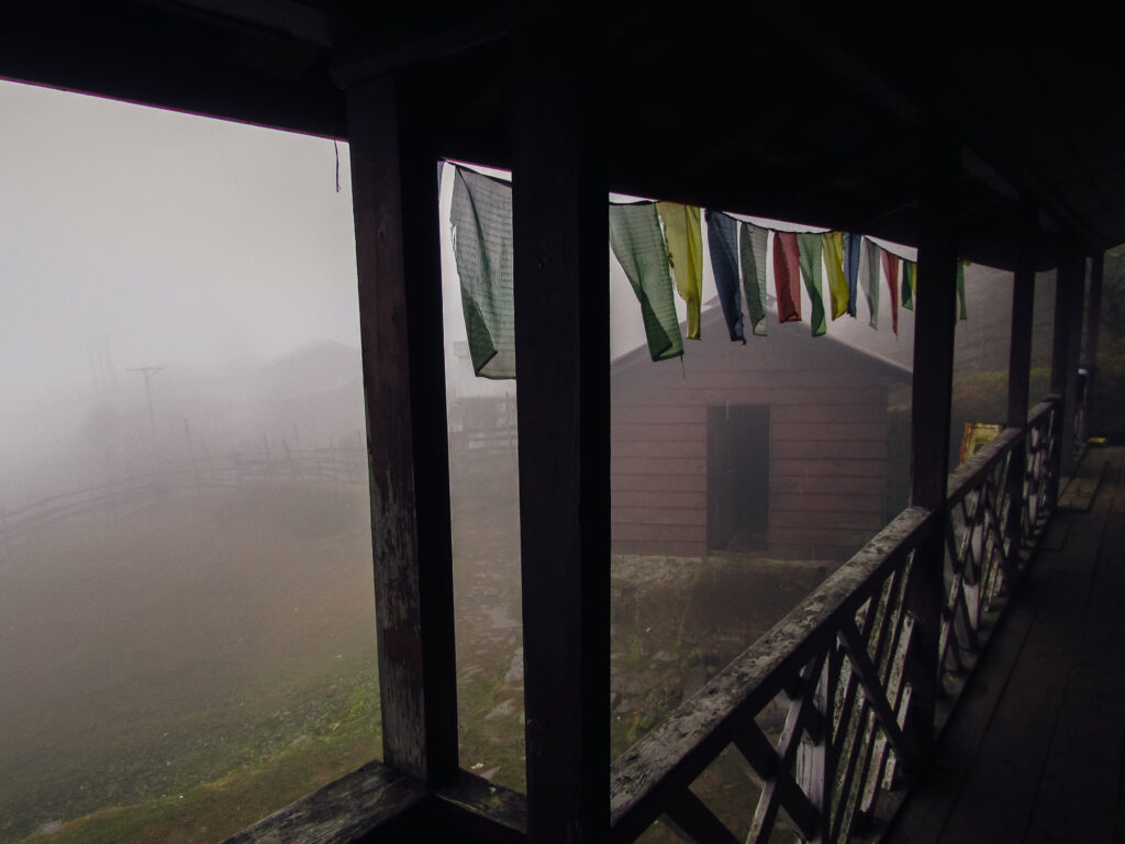
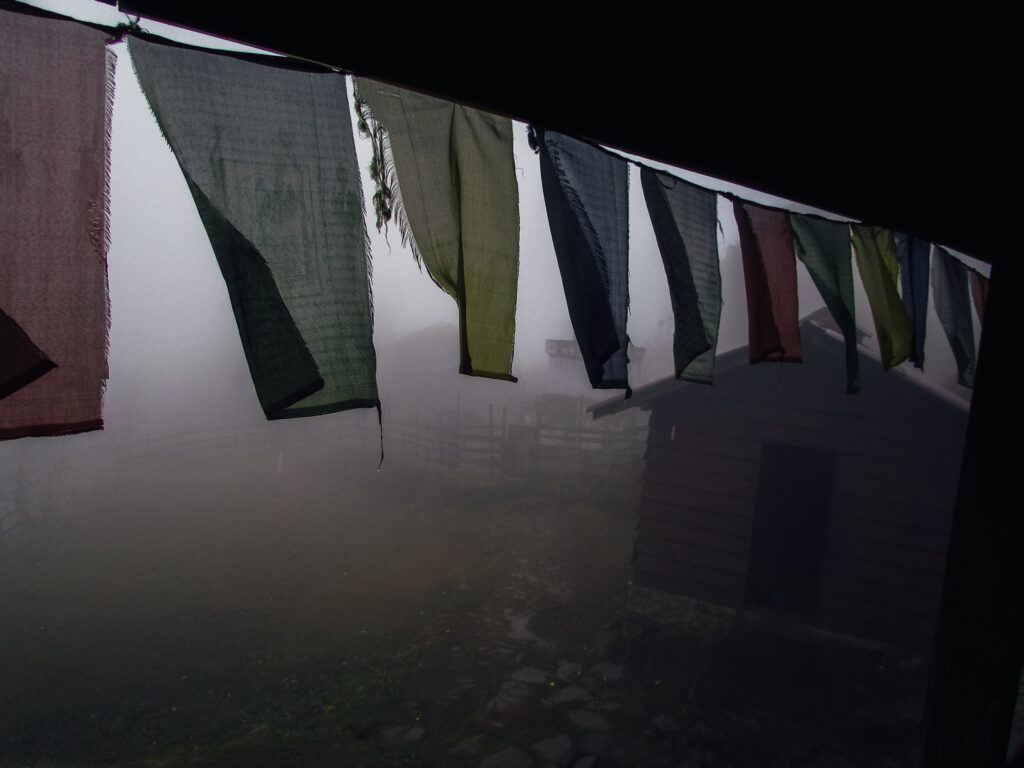
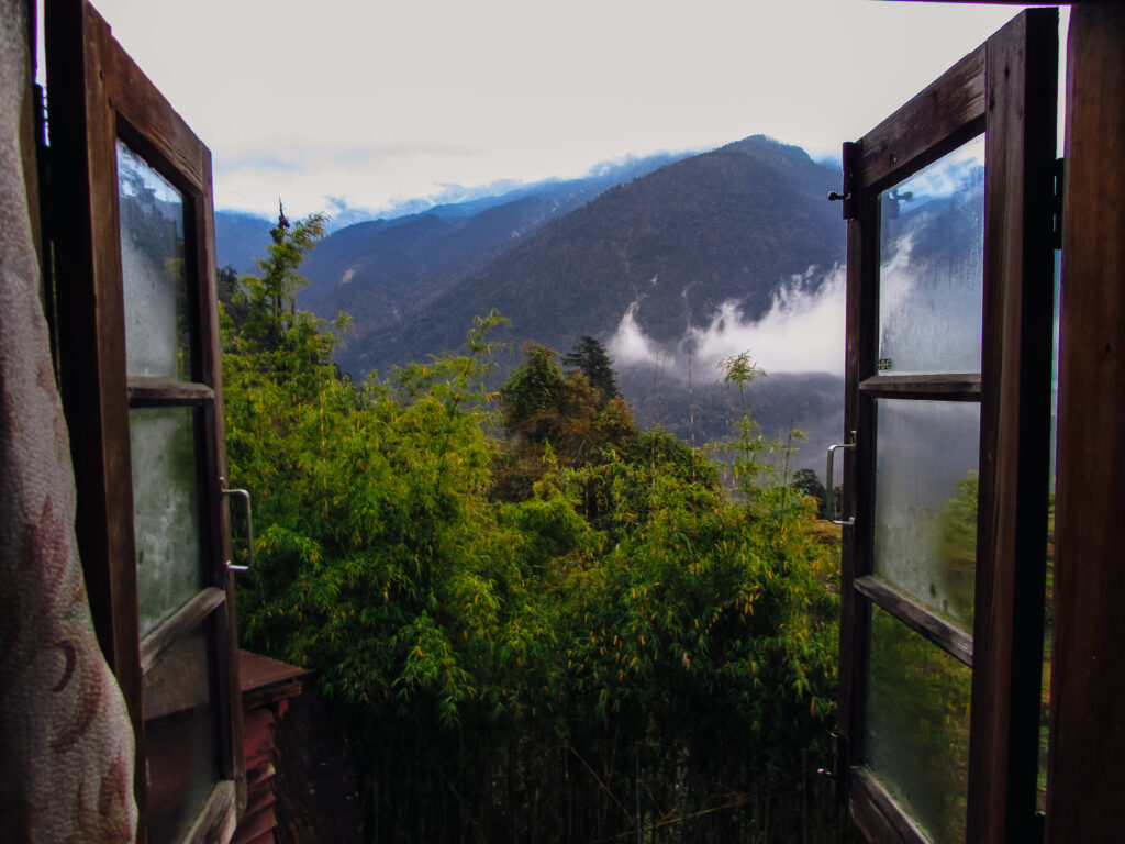
A short while after lunch we were taken on a short hike some 100 ft above the campsite to fulfil the rule of “climb high sleep low”. You could see all of Tshokha from there and it was a very pretty site to behold, with the small monastery on one side and the fog rolling in.
In the evening we visited a small shop at the campsite. It sold things like gloves, batteries, Maggie… all the stuff you usually need on such treks. That night, after dinner, we fell asleep rather quickly because everyone was just so tired. Little did I know about the mountain I would have to climb the next day (literally and figuratively)
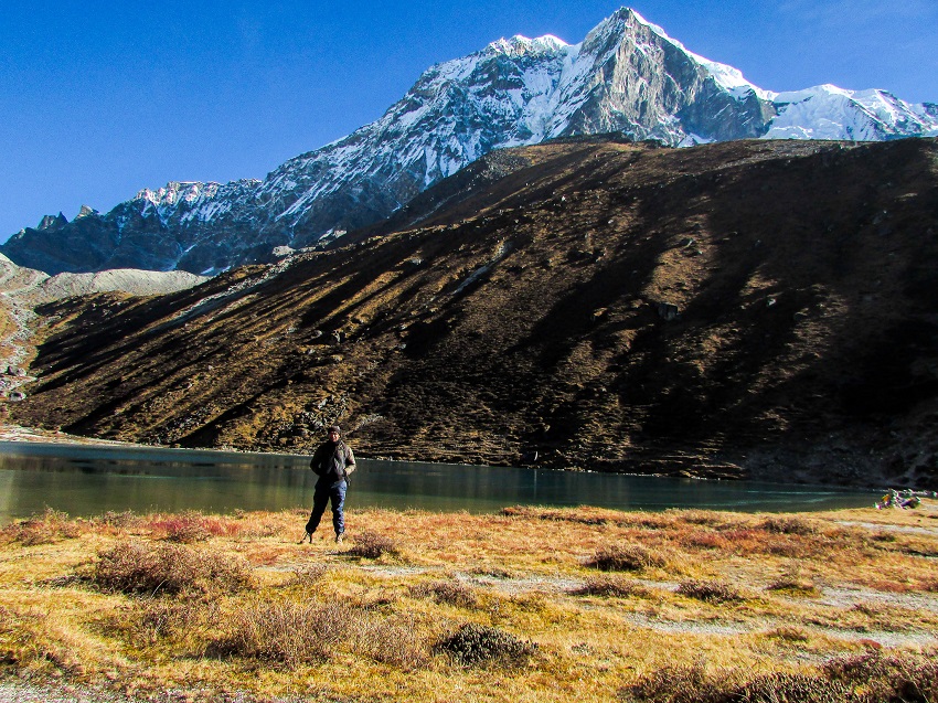
Day 4: Tshokha to Dzongri
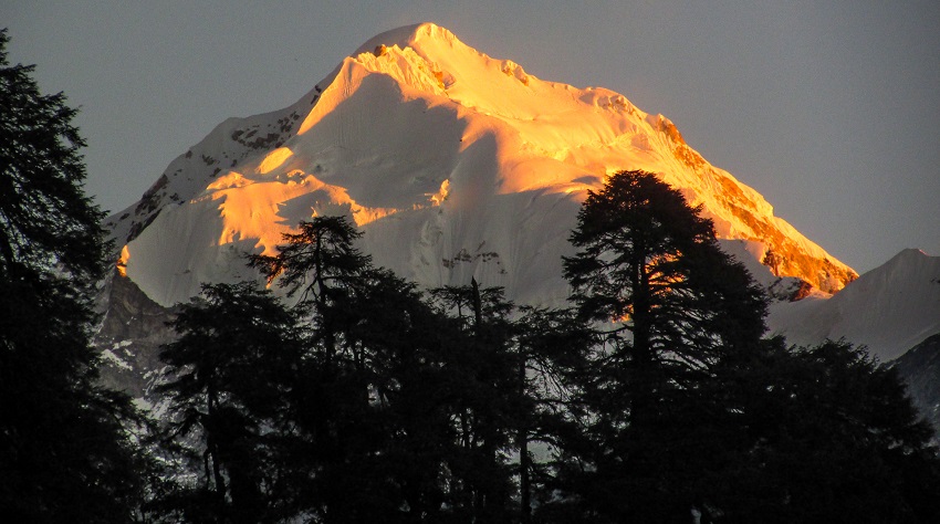
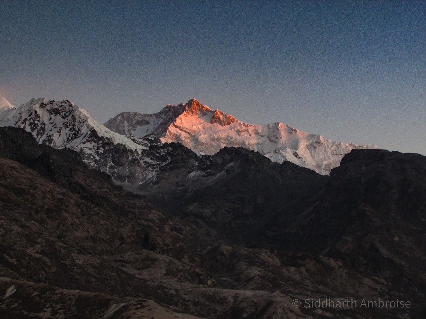
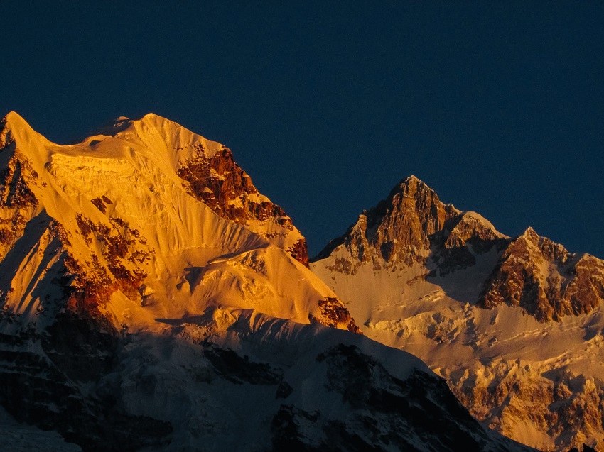
The next morning, I woke up before the sun rose; it was not by design, it’s just how I am when I am in the hills. Since there were still a few hours to breakfast and that day’s climb, I decided to do some more photography. It was a good thing too because it gave me this photo of Mt Pandim in the sunrise!
After breakfast, we packed up and headed out. The day was to be a series of climbs and walks across plateaus and let me tell you IT WASN’T EASY. Not because the climb itself was difficult but just because I was a bit unprepared for it. This is where the fitness thing comes into play. For Roopkund I was fit, in the middle of a running season, but this time I had been lazy and was not in such great shape.
Our junior trek leader 
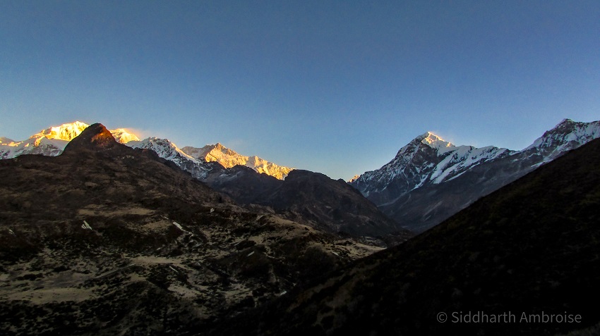
The trek was absolutely lovely but in no time, I was huffing and puffing under the weight of my backpack and the rapidly thinning air. The problem with not being fit is that it may put you in a situation where the suffering distracts you from all the beautiful sights around you. We had been told that there would be 3 climbs to deal with that day, so I was very happy when the third climb was over for two very particular reasons.
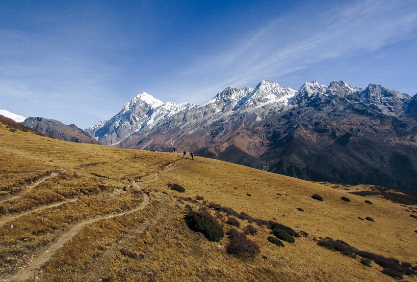
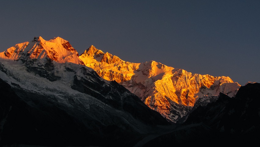
First, because the climbing was done for the day and I could look forward to a leisurely walk to the campsite. Second because when I did reach the top of the last climb, I was greeted by this sight.
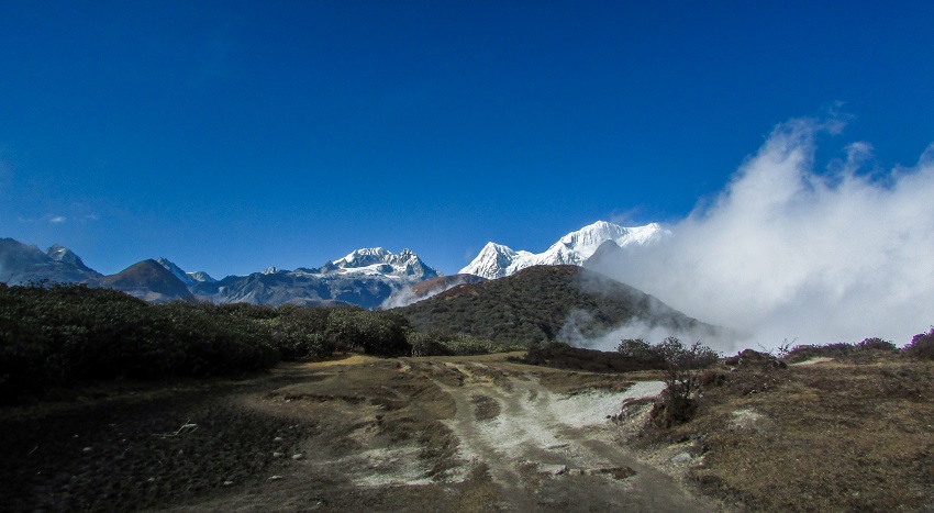
After that inspiring sight, it took me just two hours to get to the campsite at Dzongari. I was also happy to see the campsite because it meant that the break had finally arrived! The next day was a rest day to let us acclimatize to 13,000 ft (4,000 m) and I planned to sleep in and enjoy some well-earned rest.
Day 5: Rest day in Dzongari
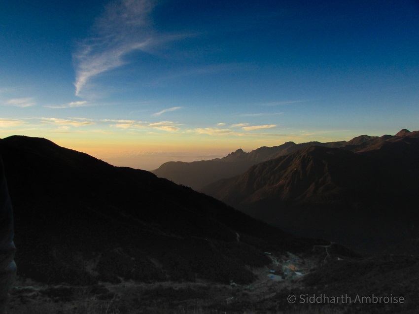
Unfortunately, our trek leader had other ideas and my hopes for sleeping in on the rest day were dashed when we were told that we will be waking up early to go see the sunrise from the top of the hill behind us. Even though I was a bit grumpy about the whole thing in the morning, when we reached the top, I had no regrets about waking up early.
After 30 very windy and chilly minutes, I headed back down to the campsite. The rest of the day was spent taking a nap in the warm sun, going for short walks here and there and just chilling with my fellow trekkers.
That night, we turned in early because we were supposed to be off the next day to the campsite of Thansing.
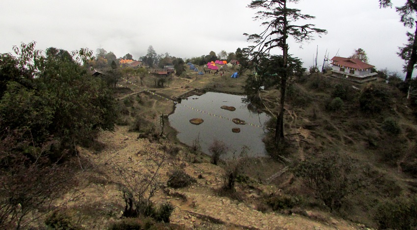
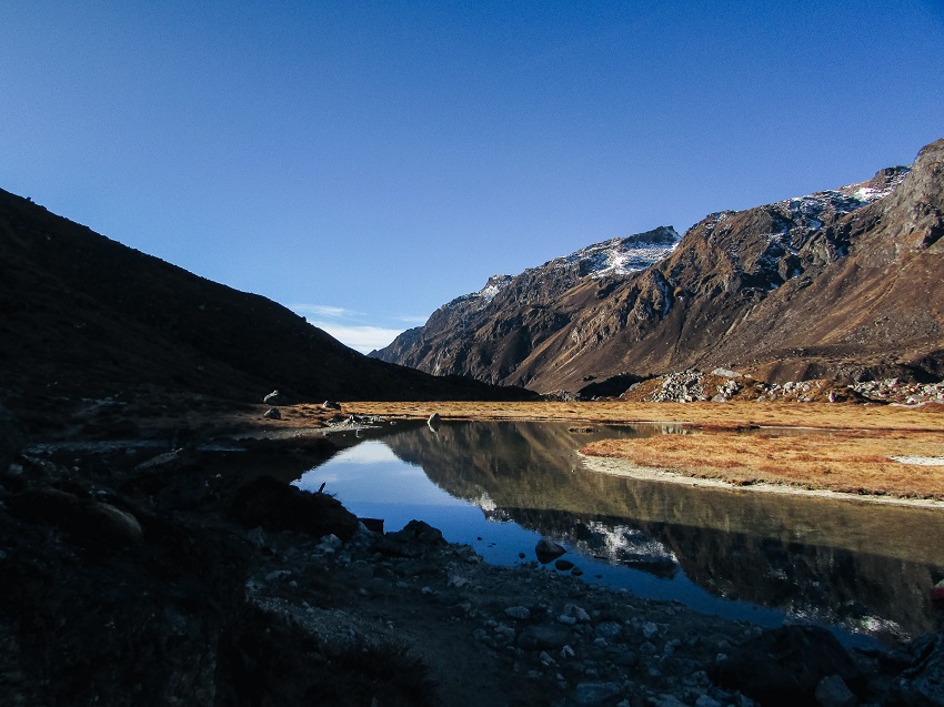
Day 6: Dzongari to Thansing via Kokcharang
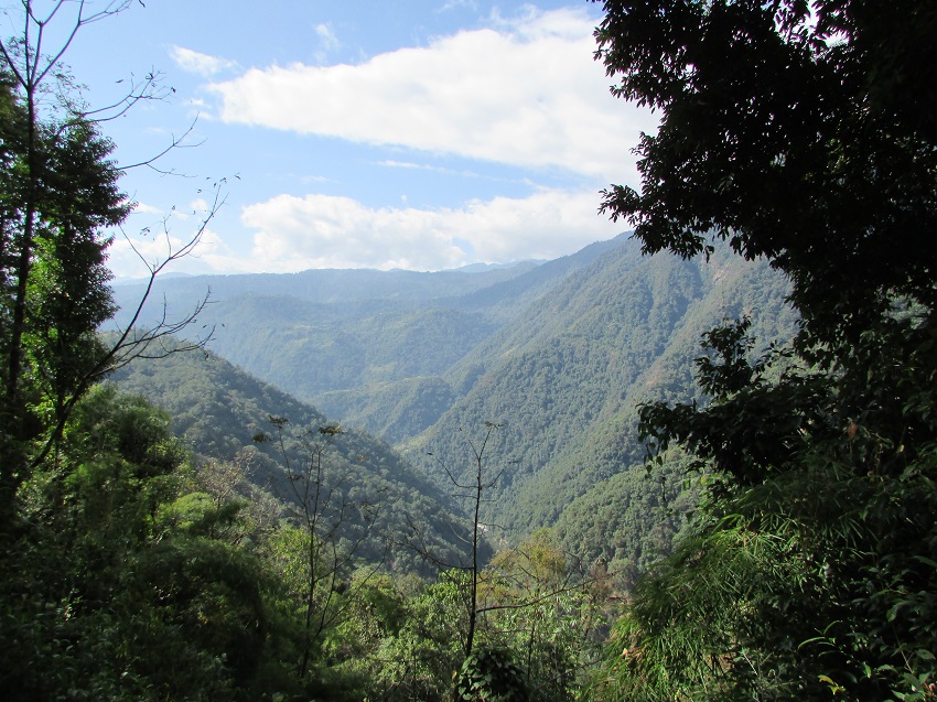
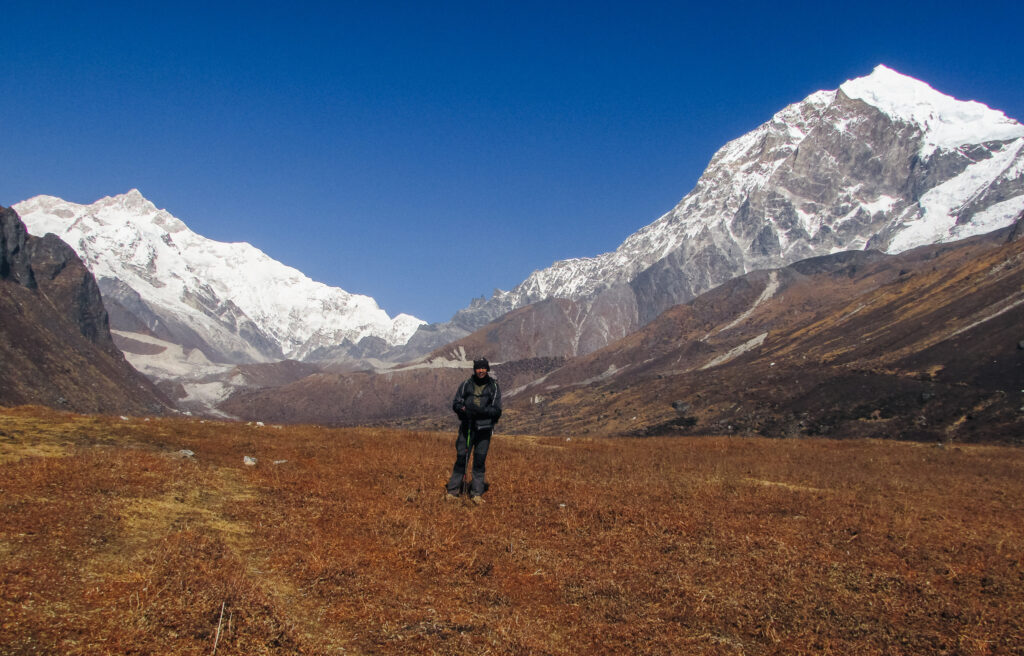
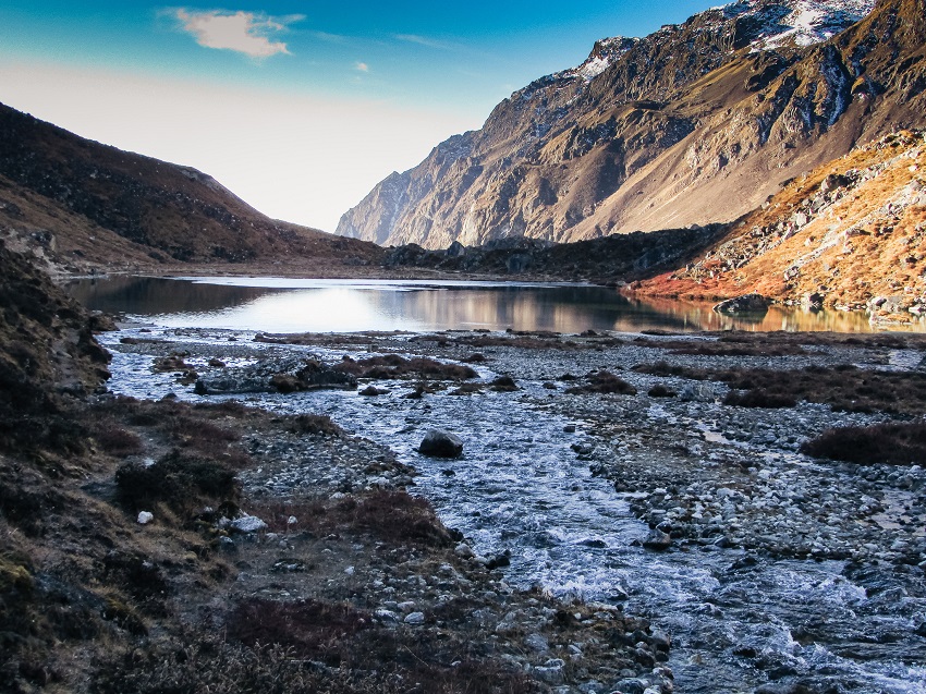
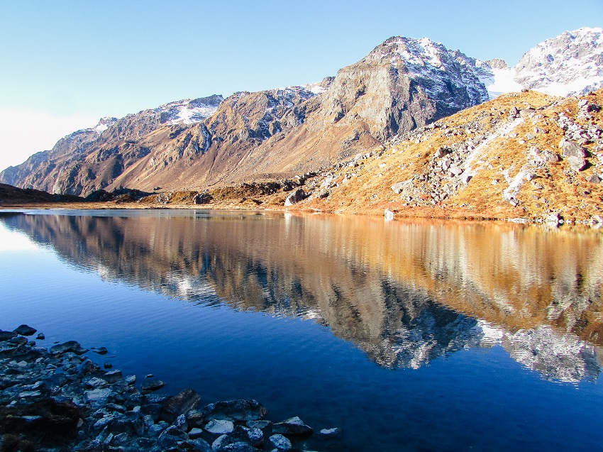
On the morning of the 6th day, I was up before the crack of dawn, as usual (it’s usually the best time to go answer the call of nature :P), and ready to move out in a short while. After breakfast, we left Dzongari for Thansing. On the way, we stopped at two places. One was at about 13,000ft (4,000 m) when we were told that there was a very pretty lake about 100 m to our left. This was the most interesting day of the trek because the scenery was the prettiest!
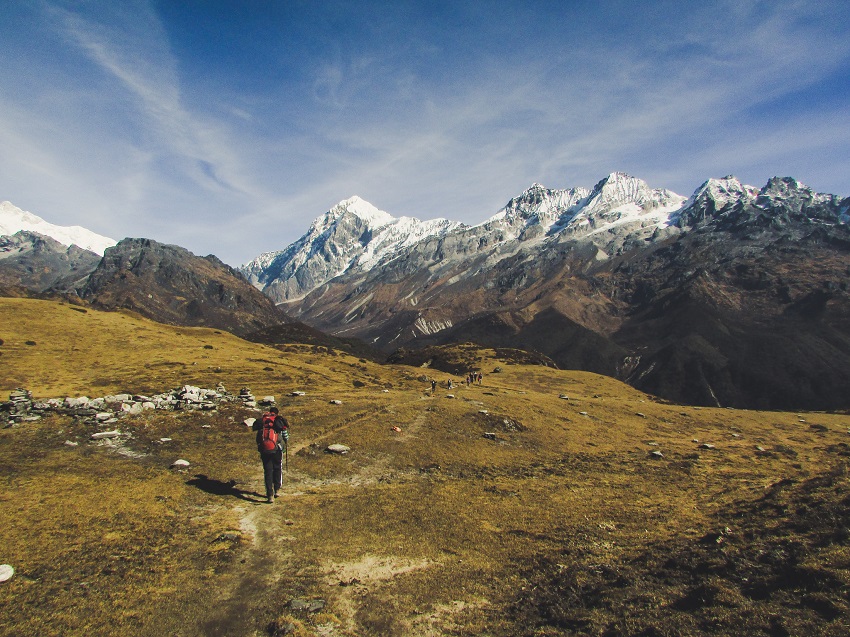
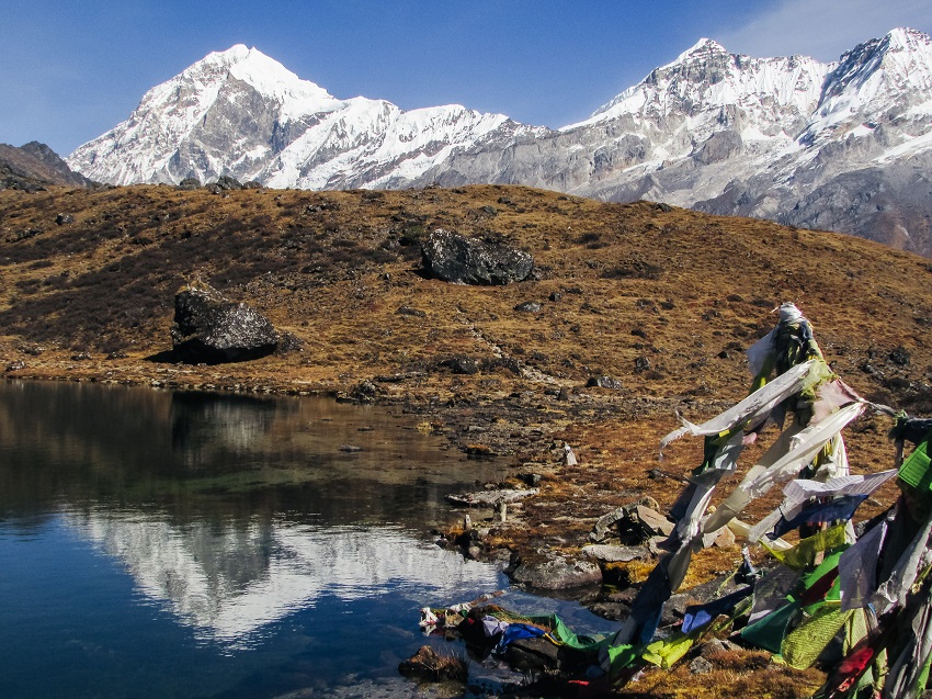
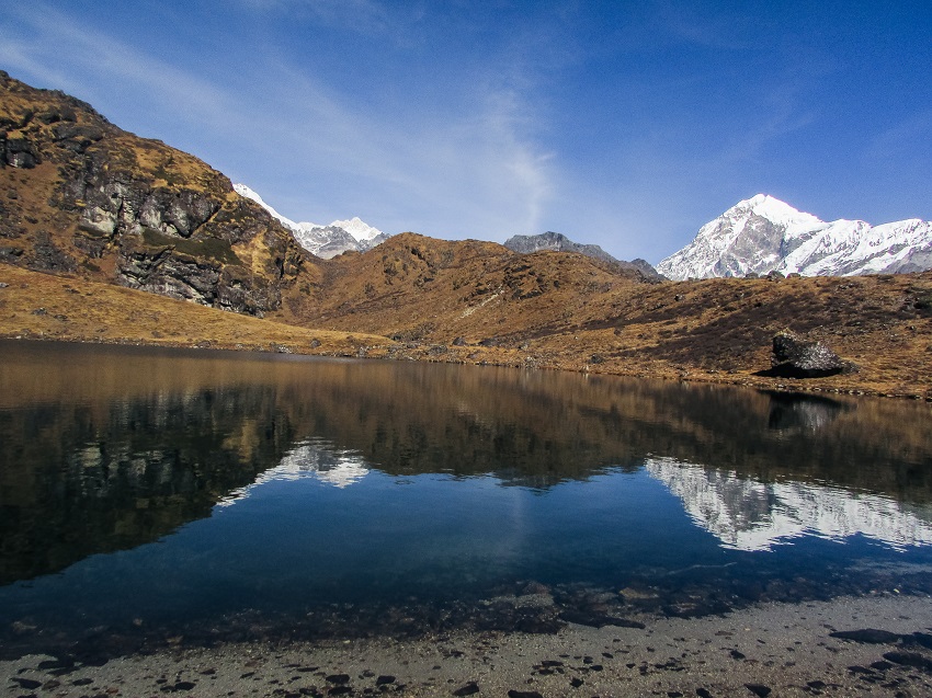
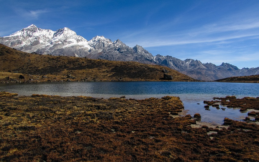
We spent about an hour at the lake and then headed down the mountain. The plan was to cross the valley below us at the campsite of Kokcharang then climb again for about an hour or so to reach the destination, Thansing.
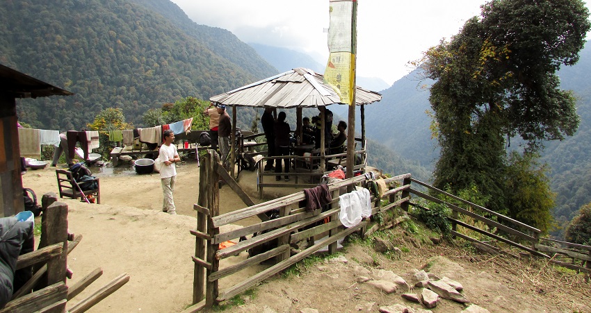
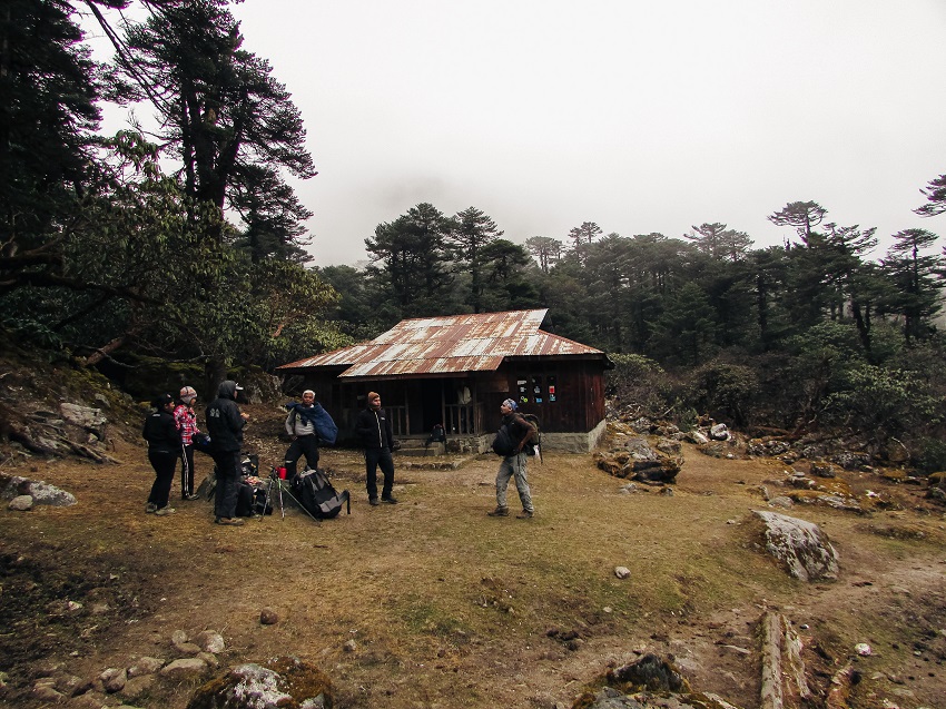
Kokcharang was a yet another pretty campsite. It’s by the bank of the river but a little further back from it. There was a trekking hut (run by the forest department) there and just about 30ft from it was a small stream that flowed into the river. The whole scene was very nice, and I was feeling a bit sad that we were not staying there.
After a quick snack, we started for the other side of the river when some clouds rolled in. Three of us decided to soldier on through the fog but when it cleared, we found ourselves walking across some VERY round and slippery rocks. The rest of the group had gone ahead, and we couldn’t see them, so we decided to take it easy least we hurt ourselves. Some tense moments passed before we reached the other side of the river and began climbing to Thansing.
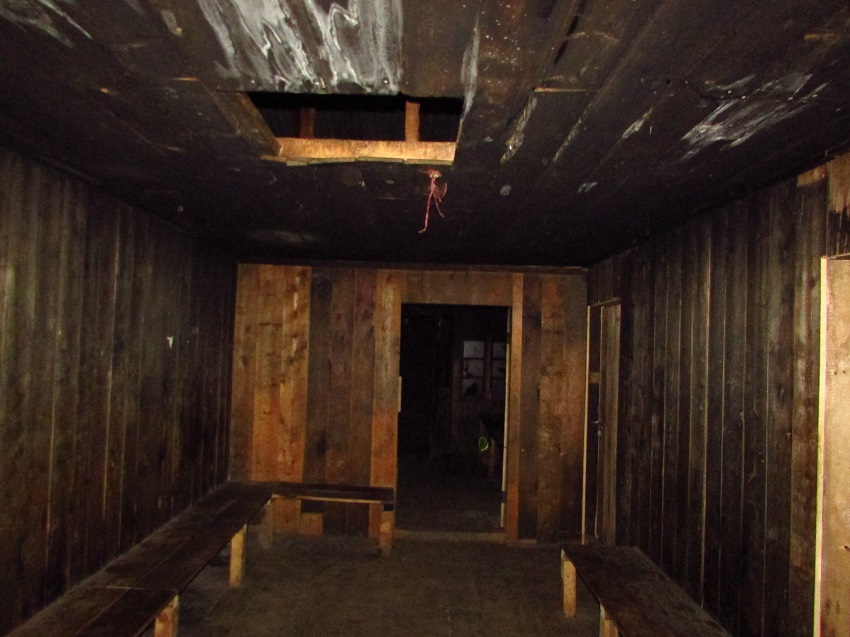
The campsite of Thansing was located in a massive valley and had a lot of open space around it. There was a trekkers hut here as well and I was happy to know that everyone had decided to forgo the tents and sleep in the hut instead. It turned out to be a good idea because I was beginning to miss the ability to stand up straight while changing.
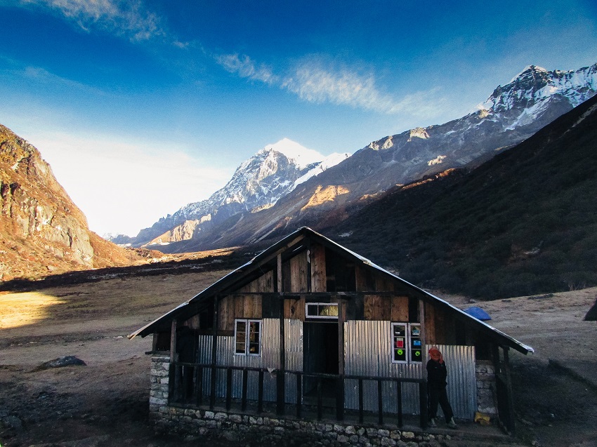
The hut had multiple rooms of different sizes and already had some other trekkers in them, so we chose an empty room and 6 of us piled in. It was a bare room with just a wooden platform to put our sleeping bags on and no electricity, a problem sorted by hanging a torch from the beams. After we settled in, it was just a matter of whiling the time away till dinner.
Tip: On the way down to Kokcharang, I noticed swelling in my left hand so when we reached the bottom of the descent, I consulted the trek leader who told me to keep my gloves on and not take them off. Something to do with altitude and the cold, I guess.
Day 7: Thansing to Lamuney
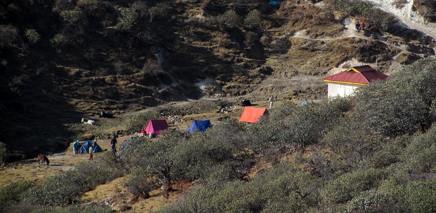
The next day we left Thansing and headed for Lamuney, our final campsite before the summit of the trek and the return journey. There was no rush in reaching the site because it was just about 1 hour from Thansing.
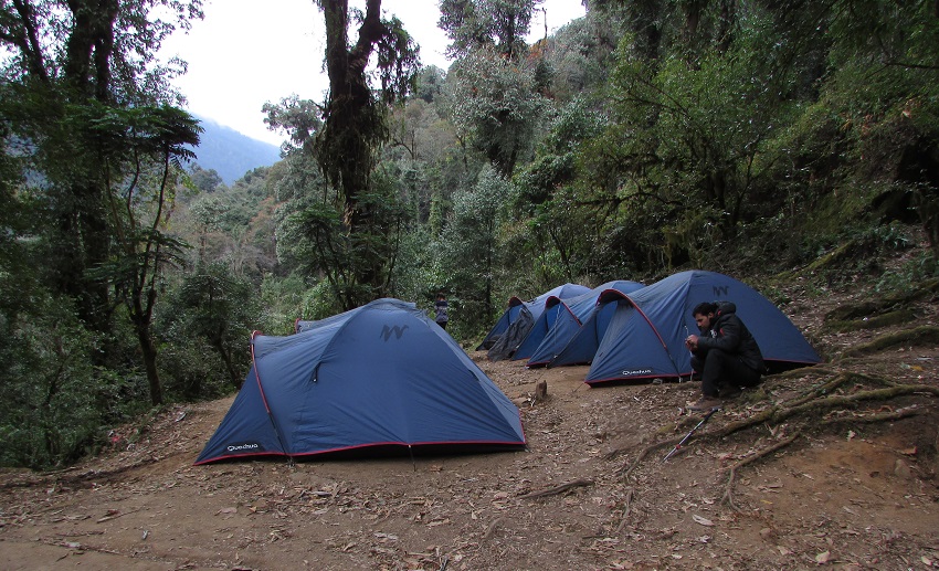
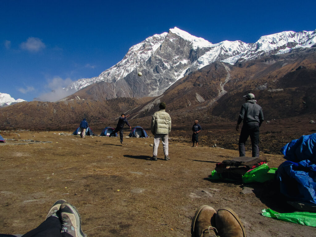
This site had nothing but a hut for the kitchen to be set up in, so it was back to the tents. We went for a short walk and explored the area while we waited for lunch. After lunch, we did a bit more exploring and the porters decided to indulge in a game of volleyball. A little later we were told the plan for the next morning.
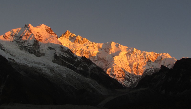
The plan was to get up at around 1 am and head for the foot of Mt Pandim. That was the climax of this trek and the plan was to get to the viewpoint before sunrise. The grand moment of getting an up-close look at Mt Kanchenjunga. With the plan set in place, we were instructed to go to sleep early and get plenty of rest.
Day 8: Lamuney to Goechala via Samiti Lake and back to Kokcharang
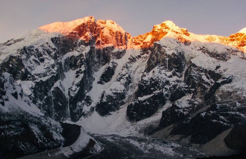
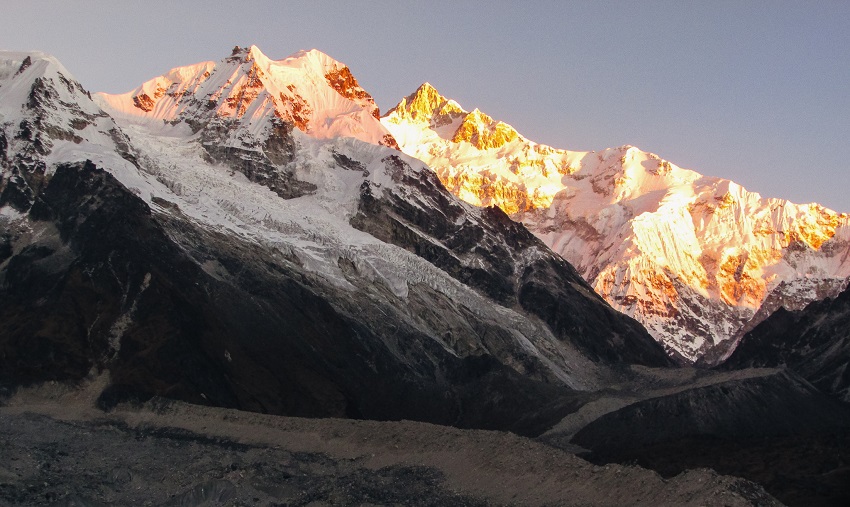
This day began at 1 am when we were woken up with some nice hot tea and told to prepare to move out. Once everyone was up and ready, we switched on our torches and headed out. It was pitch black and as we headed away from the flat ground and into the mountainous terrain, we were told that the best thing to do was to ensure that we kept the shoes of the person ahead of us in the light of our head torches.
Since it was pitch black, there was nothing really to see around us, so we just kept climbing. It was very cold, and I was patting myself on the back for deciding to wear the waterproof pants over my trekking pants because the waterproof pants managed to keep the cold wind off my legs. We were climbing for about 2 to 3 hours or so before we reached our destination.
I need not write about the awesomeness of this place, so I’ll leave it to these pictures to explain the rest.
Once we were done with sights from the top, we headed back down and took a short break, and a nap at Samiti Lake. While there we did manage to have some fun with skipping stones on a frozen lake.
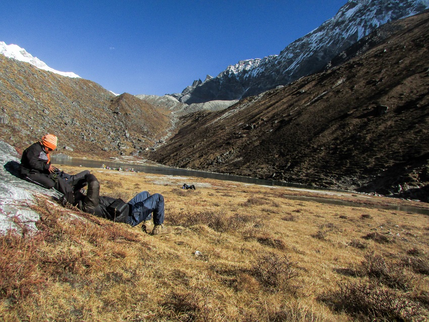
After chilling there for some time, we came back to Lamuney. After lunch, we started the trek back. The next stop, as I was happy to find out, was Kokcharang.
A few hours of walking and we were back at Kokcharang, and it was then that I realised that the route I had taken up the mountain, over the boulders while heading up to Thansing had been completely unnecessary.
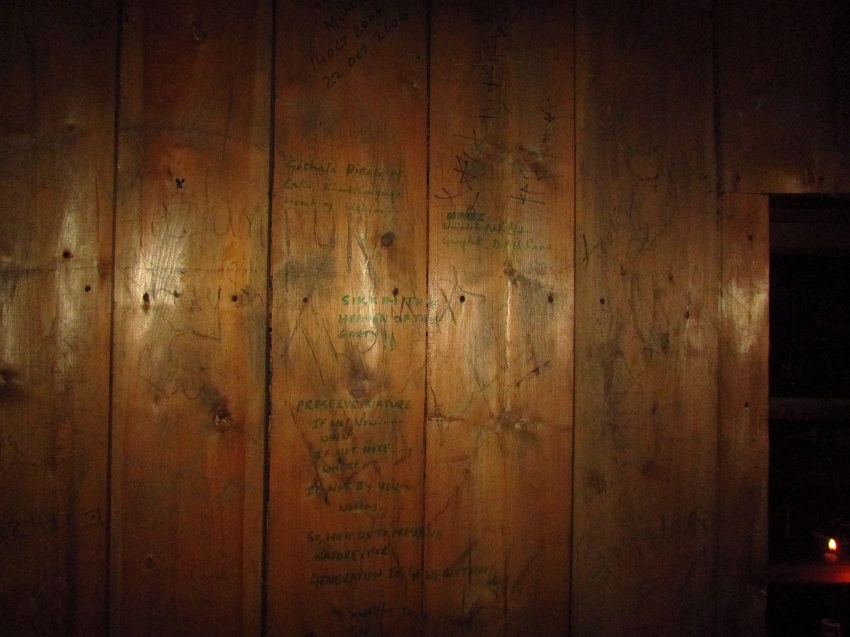
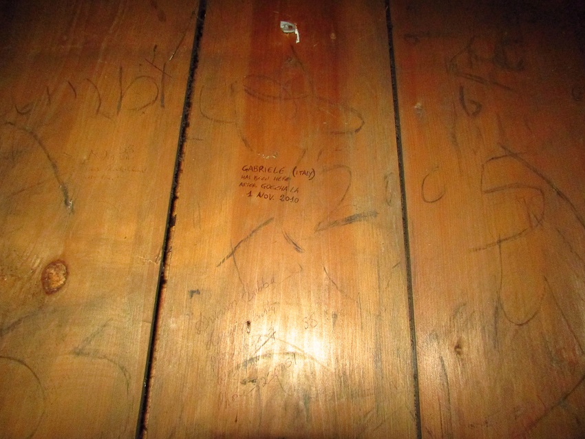
Why? Because there was a bridge right at the point, we took a wrong turn. It was right there, hidden by the fog. That night, we stayed in the trekker’s hut since ours was just one of the two groups camped there negating the need for tents.
Just like the trekkers hut at Thansing, here too it was just bare rooms for you to lay out your sleeping bags on. It was also interesting to read who all had stayed there. Lots of previous guests had carved their names in the walls of the rooms.
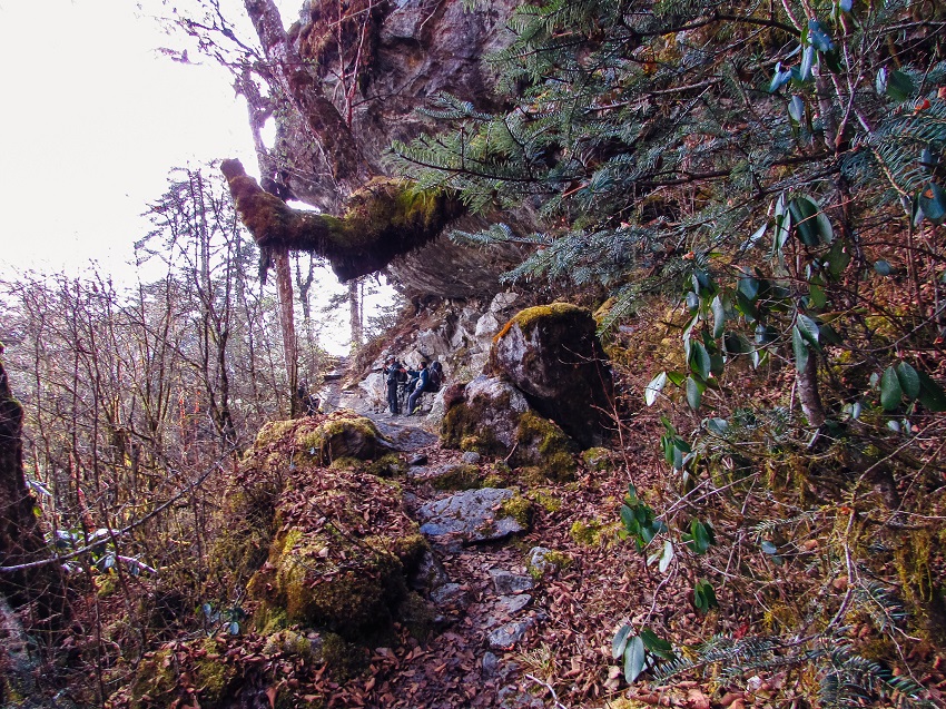
Day 9: Kokcharang to Tshokha via Phedang
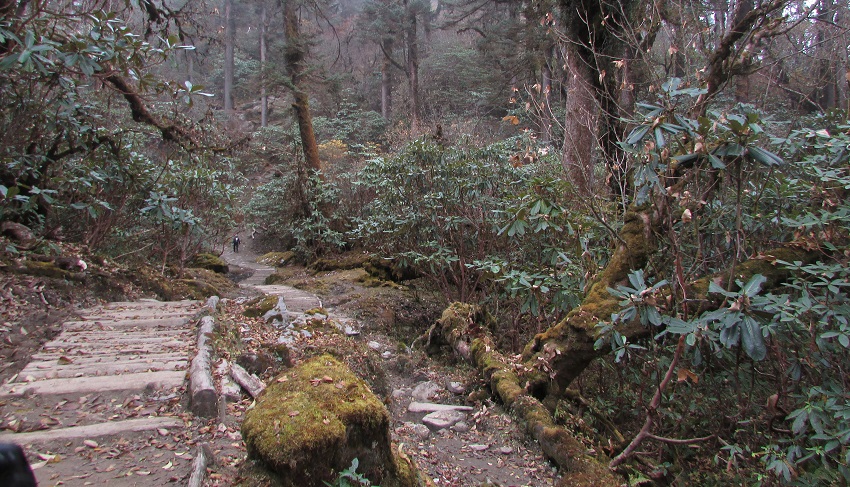
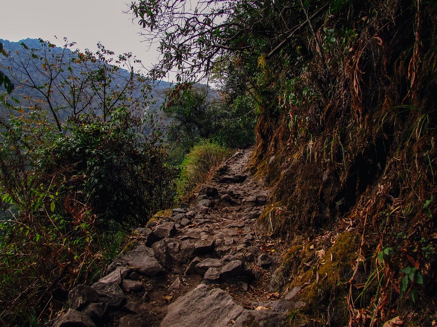
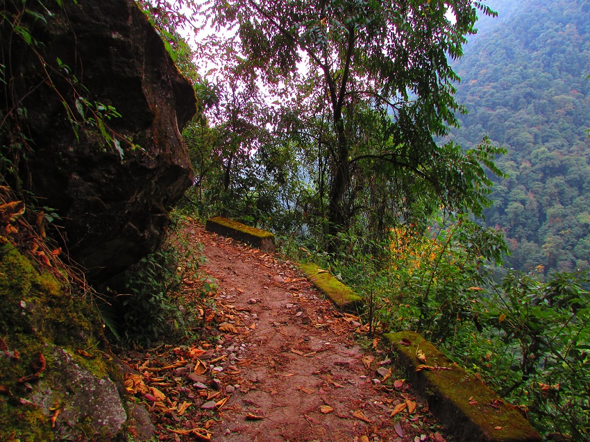
The next morning, we headed back to Tshokha, except this time, we were taking a different route from the one we took to come in. This one was narrow, very narrow, and could only be traversed by people. We walked across two small landslides (we had to go one at a time as the path was barely 6 inches across) and through red panda territory (no, we didn’t see any Red Pandas).
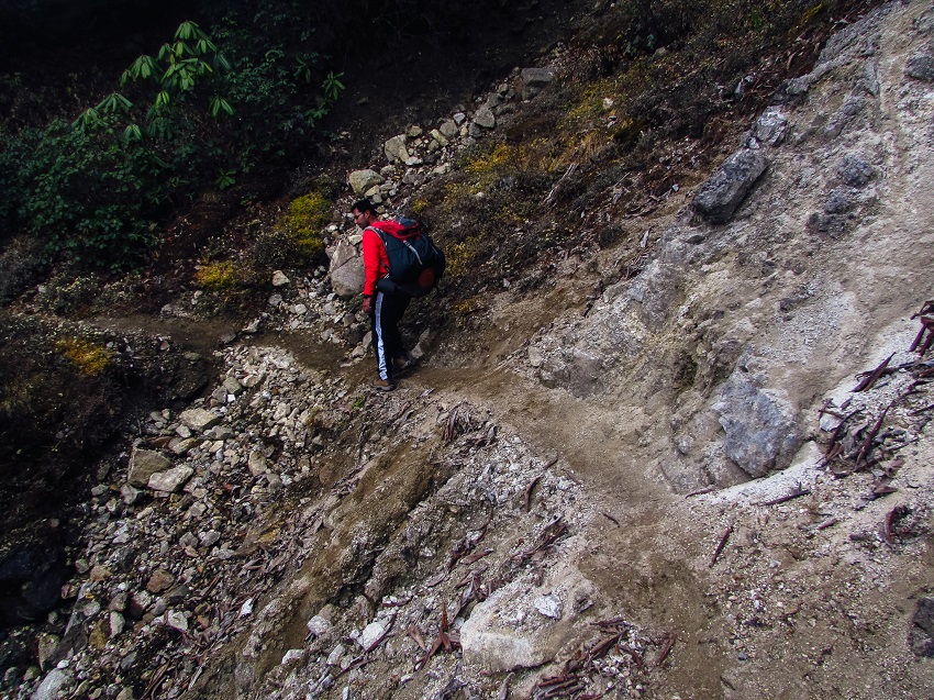
Walking across a small landslide 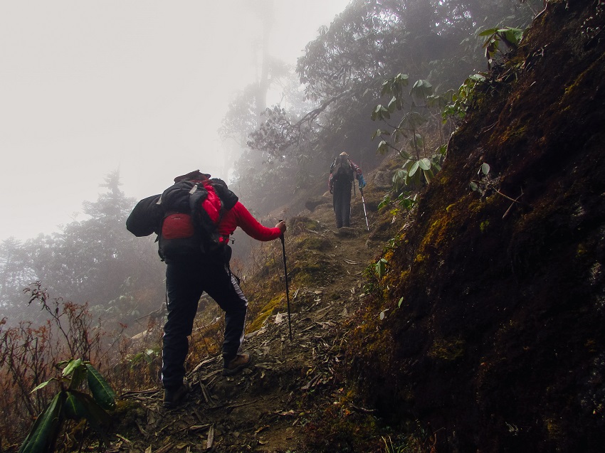
This was one of the longer days of the trek, but it was a great walk. After a long day walk, we ended up back in Tshokha where we decided to stay in the trekker’s hut instead of the tents. This was to be our last day in the mountains because the next day we would be back in Yuksom and preparing to head back to NJP.
I thought I’ll pitch my tent and spend the last night in the tent but eventually decided to join everyone and it turned out to be a really good decision because it had begun to rain, and it was nice and dry inside.
Day 10: Tshokha to Yuksom
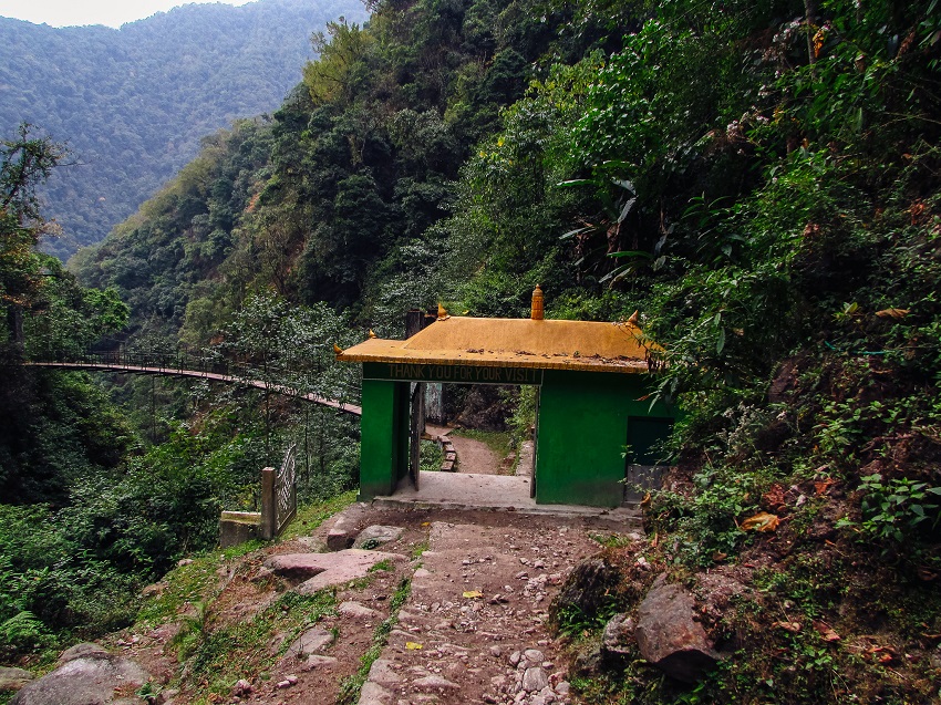
The last day of the trek, we got up and packed one last time before we headed back. By evening we would be back in Yuksom and back to a warm bed and a hot shower. The return was largely uneventful and in a few short hours, we were back at the gate of Kanchenjunga National Park. 30 minutes later we were back at the guest house we started from.
That night we celebrated our completion of the Goechala Trek with a nice dinner and some local drink after which we retired to our rooms one last time before heading out to NJP the next day.
Day 11: Yuksom to NJP
This an uneventful day because all we did was to pack up our things and load up in the jeep, we came in. Not all of us were going back because some were going onto a sightseeing tour of the area. The rest of us drove back to New Jalpaiguri.
Goechala vs Roopkund trek
The main difference between the Goechala Trek and the Roopkund Trek was that the terrain was wildly different. Here, as opposed to the Garhwal Hills, the hills in Sikkim are much steeper and the forests denser. Some of the other differences between these two treks are that Goechala is a longer and tougher trek. The duration of this trek is also longer in this trek. The altitude gain is also a bit slower here than in Roopkund.
Overall, both the treks are very different and are very pretty. Goechala may be a bit more ardours so if you plan to do this trek, you better come prepared.
The only regret
After having done 2 more treks after this one, I still maintain that if there was a trek that I would love to go back to, it would be this one. One reason for this decision is that because this is a truly spectacular trek, but my biggest reason is my regret. It was on the last day, as we were nearing the gates of the national park that had this horrible feeling that I had somehow missed most of the trek.
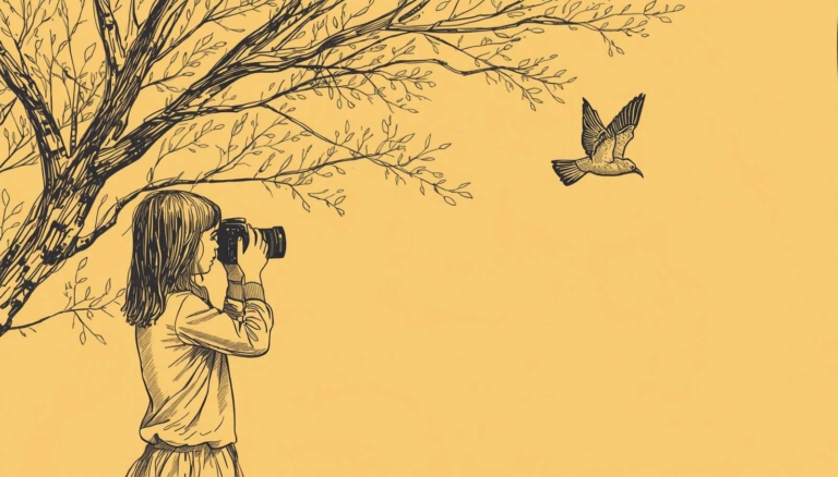
I didn’t seem to remember bits of it in as much detail as I did the moments of the Roopkund Trek. It was then that I realised that I probably knew why I felt that way. The answers were in my hands and it occurred to me that for a sizeable amount of the time, I was so busy documenting the trek through the camera that I had not taken the time to appreciate where I was.
So, here’s my 2 cents worth for you, I still go for treks, and I still take lots and lots of photographs but don’t forget to enjoy where I am. Sometimes it’s better to not document every single thing.


_Passenger.jpg)